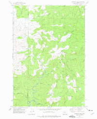
1974 Map of Warnicke Creek
USGS Topo · Published 1976About this map
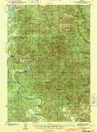
The Lincoln Co Polk Co line divides this heavily timbered portion of the Oregon Coast Range, where industrial activity is defined by an extensive network of haul roads and extraction sites. Numerous borrow pits and quarries dot the landscape, particularly surrounding Warnicke Creek and Boulder Creek, indicating the intense road-building and maintenance required for mid-century logging operations. The terrain is characterized by sharp elevations like Stott Mtn and Sugarloaf Mountain, with various Falls and Rapids marking the steep descent of waterways toward the North Fork Siletz River.
Find a feature on this map
33 named features on this map. Tap any name to fly to it.
Don’t see what you’re looking for? This feature index may not catch every label — zoom into the map to look around manually.
Map Details
Editions of this 1974 Warnicke Creek Map
This is the sole edition of this map. No revisions or reprints were ever made.
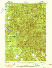
Other maps of this area

1941 · Nestucca Bay
USGS Topo · 1:62,500
1942 · Euchre Mtn
USGS Topo · 1:62,500
1942 · Spirit Mtn
USGS Topo · 1:62,500

1942 · Nestucca Bay
USGS Topo · 1:62,500
1942 · Valsetz
USGS Topo · 1:62,500
1943 · Euchre Mtn
USGS Topo · 1:62,500

1948 · Vancouver
USGS Topo · 1:250,000

1950 · Vancouver
USGS Topo · 1:250,000

1950 · Vancouver
USGS Topo · 1:250,000

1953 · Salem
USGS Topo · 1:250,000