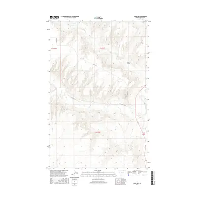
2017 Map of Fanny Hill
USGS Topo · Published 2017About this map
The Milk River defines the eastern edge of this Phillips County landscape, where the prairie breaks into complex drainage patterns and prominent rises. Named for its elevation, Fanny Hill sits above the intersection of local routes including Cottonwood Creek Rd and Fanning Hill Rd. The terrain is characterized by a series of coulees and seasonal watercourses, most notably Austin Coulee and the headwaters of Little Cottonwood Cr, which cut through the high plains. This map illustrates the sparse, rural infrastructure of the region, where long-established dirt roads like Cottonwood Rd follow the natural contours of the land. The surveying boundaries of T33N R30E and T32N R30E provide a clear framework for locating specific parcels in this remote section of northern Montana.
Find a feature on this map
13 named features on this map. Tap any name to fly to it.
Don’t see what you’re looking for? This feature index may not catch every label — zoom into the map to look around manually.
Map Details
Editions of this 2017 Fanny Hill Map
This is the sole edition of this map. No revisions or reprints were ever made.
Other maps of this area

1905 · Bowdoin
USGS Topo · 1:62,500

1920 · Cowan
USGS Topo · 1:125,000

1954 · Glasgow
USGS Topo · 1:250,000

1957 · Glasgow
USGS Topo · 1:250,000

1958 · Glasgow
USGS Topo · 1:250,000
1968 · Malta NE
USGS Topo · 1:24,000

1968 · Austin Lake
USGS Topo · 1:24,000

1968 · Hewitt Lake SW
USGS Topo · 1:24,000
1968 · Malta NW
USGS Topo · 1:24,000
1984 · Garland Creek
USGS Topo · 1:24,000