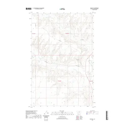
2020 Map of Fanny Hill
USGS Topo · Published 2020About this map
Fanny Hill and the drainage systems of north-central Montana define this Phillips County landscape as surveyed in 2020. The terrain is deeply inscribed by seasonal waterways and dramatic elevation shifts, most notably at Austin Coulee in the northeast and the meandering course of the Milk River along the eastern margin. This map documents a sparsely populated ranching region where movement is dictated by a few critical arteries, including Fanning Hill Rd and Cottonwood Rd. The hydrography is particularly detailed, showing the convergence of Little Cottonwood Cr, Garland Cr, and Cottonwood Cr. These features illustrate the complex topographical character of the Missouri River watershed, where high ridges like Fanny Hill overlook the broad coulees and creek beds that have supported grazing and land use for generations.
Find a feature on this map
13 named features on this map. Tap any name to fly to it.
Don’t see what you’re looking for? This feature index may not catch every label — zoom into the map to look around manually.
Map Details
Editions of this 2020 Fanny Hill Map
This is the sole edition of this map. No revisions or reprints were ever made.
Other maps of this area

1905 · Bowdoin
USGS Topo · 1:62,500

1920 · Cowan
USGS Topo · 1:125,000

1954 · Glasgow
USGS Topo · 1:250,000

1957 · Glasgow
USGS Topo · 1:250,000

1958 · Glasgow
USGS Topo · 1:250,000
1968 · Malta NE
USGS Topo · 1:24,000

1968 · Austin Lake
USGS Topo · 1:24,000

1968 · Hewitt Lake SW
USGS Topo · 1:24,000
1968 · Malta NW
USGS Topo · 1:24,000
1984 · Garland Creek
USGS Topo · 1:24,000