
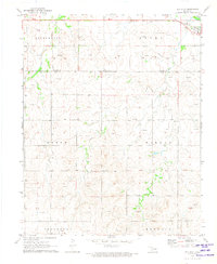
1969 Map of Fargo NW
USGS Topo · Published 1971About this map
Wolf Creek winds through the southern landscape of this Oklahoma survey, where the township of Fargo sits near the southeastern corner. The terrain is defined by the drainage basins of Eightmile Creek and Sixteenmile Creek, which carve through the high plains. Local life in the late 1960s centered around landmarks like Greenwood Ch and the nearby Sunset Cem.
Find a feature on this map
12 named features on this map. Tap any name to fly to it.
Don’t see what you’re looking for? This feature index may not catch every label — zoom into the map to look around manually.
Map Details
Editions of this 1969 Fargo NW Map
This is the sole edition of this map. No revisions or reprints were ever made.
Other maps of this area

1955 · Woodward
USGS Topo · 1:250,000

1958 · Woodward
USGS Topo · 1:250,000

1969 · Fargo SW
USGS Topo · 1:24,000

1969 · Fargo
USGS Topo · 1:24,000

1969 · Gage
USGS Topo · 1:24,000

1969 · Fargo SE
USGS Topo · 1:24,000

1969 · Shattuck NE
USGS Topo · 1:24,000

1971 · May East
USGS Topo · 1:24,000

1971 · Fort Supply
USGS Topo · 1:24,000
1971 · May West
USGS Topo · 1:24,000