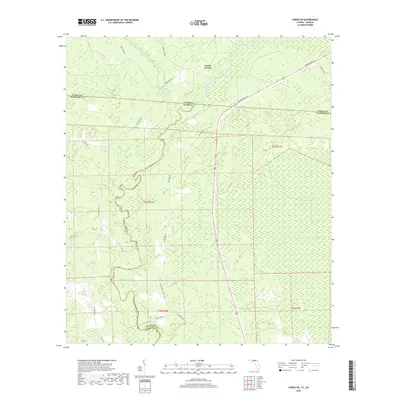
2018 Map of Fargo SW
USGS Topo · Published 2018About this map
The Suwannee River carves a winding path through this North Florida and South Georgia borderland, defining a landscape dominated by extensive wetlands and swampy basins. Low-lying terrain like Bear Bay and Sandlin Bay characterizes the topography, where drainage is primarily facilitated by seasonal watercourses such as Rocky Cr. The map captures a section of the deep south where the state line between Georgia and Florida meets the intersection of Hamilton, Columbia, and Echols counties.
Find a feature on this map
25 named features on this map. Tap any name to fly to it.
Don’t see what you’re looking for? This feature index may not catch every label — zoom into the map to look around manually.
Map Details
Editions of this 2018 Fargo SW Map
This is the sole edition of this map. No revisions or reprints were ever made.
Other maps of this area

1954 · Valdosta
USGS Topo · 1:250,000

1955 · Council
USGS Topo · 1:24,000

1955 · Cypress Creek
USGS Topo · 1:24,000

1955 · Fargo SW
USGS Topo · 1:24,000

1958 · Valdosta
USGS Topo · 1:250,000

1959 · Valdosta
USGS Topo · 1:250,000

1962 · Genoa
USGS Topo · 1:24,000

1967 · Fargo
USGS Topo · 1:24,000

1968 · Needmore
USGS Topo · 1:24,000
1969 · Benton
USGS Topo · 1:24,000