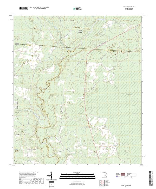
2024 Map of Fargo SW
USGS Topo · Published 2024About this map
The Suwannee River carves a winding path through this low-lying borderland, marking the historic boundary where Echols County, Georgia, meets Hamilton and Columbia Counties in Florida. The landscape is defined by vast wetland systems like Sandlin Bay and Bear Bay, which dominate the eastern and southwestern reaches of the quadrangle. These natural depressions dictate the modern road network, forcing routes like the Woodpecker Rte to navigate around the water-saturated terrain.
Find a feature on this map
28 named features on this map. Tap any name to fly to it.
Don’t see what you’re looking for? This feature index may not catch every label — zoom into the map to look around manually.
Map Details
Editions of this 2024 Fargo SW Map
This is the sole edition of this map. No revisions or reprints were ever made.
Other maps of this area

1954 · Valdosta
USGS Topo · 1:250,000

1955 · Council
USGS Topo · 1:24,000

1955 · Cypress Creek
USGS Topo · 1:24,000

1955 · Fargo SW
USGS Topo · 1:24,000

1958 · Valdosta
USGS Topo · 1:250,000

1959 · Valdosta
USGS Topo · 1:250,000

1962 · Genoa
USGS Topo · 1:24,000

1967 · Fargo
USGS Topo · 1:24,000

1968 · Needmore
USGS Topo · 1:24,000
1969 · Benton
USGS Topo · 1:24,000