
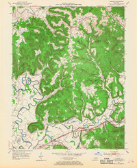
1953 Map of Farmers
USGS Topo · Published 1954About this map
The Licking River winds through this 1953 landscape, defining the borders of Rowan, Bath, and Fleming counties. The central community of Farmers sits along the Chesapeake and Ohio railroad, a vital artery for the region's mid-century river-and-rail economy. Significant river access points like Moores Ferry and Moores Ford are documented here, alongside distinct oxbows such as Muleshoe Bend and Horseshoe Bend. The topography is a dense network of hollows and ridges, from Sugarloaf Mountain in the northeast to Green Mountain in the southwest.
Find a feature on this map
66 named features on this map. Tap any name to fly to it.
Don’t see what you’re looking for? This feature index may not catch every label — zoom into the map to look around manually.
Map Details
Editions of this 1953 Farmers Map
2 editions found
Other maps of this area

1929 · Morehead
USGS Topo · 1:48,000

1929 · Salt Lick
USGS Topo · 1:62,500

1934 · Salt Lick
USGS Topo · 1:62,500

1935 · Morehead
USGS Topo · 1:62,500

1951 · Cranston
USGS Topo · 1:24,000

1951 · Hillsboro
USGS Topo · 1:24,000

1951 · Plummers Landing
USGS Topo · 1:24,000

1953 · Olympia
USGS Topo · 1:24,000

1953 · Bangor
USGS Topo · 1:24,000
1953 · Salt Lick
USGS Topo · 1:24,000