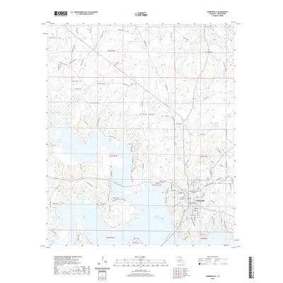
2020 Map of Farmerville
USGS Topo · Published 2020About this map
Farmerville serves as the focal point of this Union Parish survey, situated along the complex eastern shoreline of Bayou D'Arbonne Lake. The town's grid is anchored by the Union Parish Courthouse, with residential development extending toward the surrounding bayous and creeks. The landscape is defined by the branching arms of the reservoir, which inundates the former valleys of Horse Trough Cr, Boatwright Cr, and Hunnistett Cr.
Find a feature on this map
118 named features on this map. Tap any name to fly to it.
Don’t see what you’re looking for? This feature index may not catch every label — zoom into the map to look around manually.
Map Details
Editions of this 2020 Farmerville Map
This is the sole edition of this map. No revisions or reprints were ever made.
Other maps of this area

1950 · Ruston
USGS Topo · 1:62,500

1951 · Ruston
USGS Topo · 1:62,500

1951 · Bernice
USGS Topo · 1:62,500

1952 · Calhoun
USGS Topo · 1:62,500

1952 · Farmerville
USGS Topo · 1:62,500

1955 · Shreveport
USGS Topo · 1:250,000

1956 · Shreveport
USGS Topo · 1:250,000
1982 · Point
USGS Topo · 1:24,000
1982 · Downsville North
USGS Topo · 1:24,000

1984 · Shreveport
USGS Topo · 1:250,000