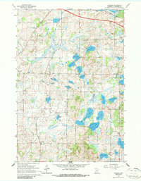
1965 Map of Farming
USGS Topo · Published 1986About this map
The unincorporated community of Farming anchors the southwestern corner of this mid-1960s landscape, an area characterized by a dense network of glacial lakes and wetlands in rural Stearns County. Water dominates the geography, with clusters of family-named water bodies such as Backes Lake, Kranz Lake, and Mauritz Lake interspersed with larger basins like Big Rice Lake and Clear Lake. Transportation and utility infrastructure are evident through the Great Northern railroad line cutting across the northeast and County Ditch No 6 draining the central marshlands.
Find a feature on this map
36 named features on this map. Tap any name to fly to it.
Don’t see what you’re looking for? This feature index may not catch every label — zoom into the map to look around manually.
Map Details
Editions of this 1965 Farming Map
2 editions found
Other maps of this area

1953 · Saint Cloud
USGS Topo · 1:250,000

1957 · Saint Cloud
USGS Topo · 1:250,000

1958 · Saint Cloud
USGS Topo · 1:250,000

1965 · Albany
USGS Topo · 1:24,000

1965 · Farming
USGS Topo · 1:24,000

1965 · Holdingford
USGS Topo · 1:24,000

1965 · Freeport
USGS Topo · 1:24,000

1965 · St Martin
USGS Topo · 1:24,000

1965 · Avon
USGS Topo · 1:24,000

1967 · Cold Spring
USGS Topo · 1:24,000