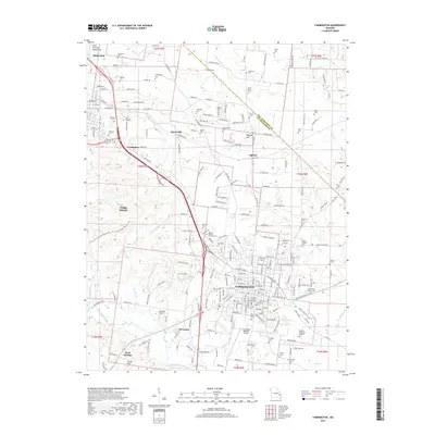
2017 Map of Farmington
USGS Topo · Published 2017About this map
The city of Farmington serves as the primary urban center for this portion of the Saint Francois Mountains foothills, showing a dense street grid that includes the Masonic Cem of Farmington and the Saint Paul Lutheran Cem. To the northwest, the map details the contiguous developments of Park Hills, Leadington, and Desloge, a cluster of communities historically shaped by the regional mining industry. Educational and transportation infrastructure is prominent, with the Mineral Area Coll campus situated near Hurryville and the Farmington Regional Airport to the south. Numerous family and community cemeteries, such as the Negro Masonic Cem and Mattie Roberts Memorial Cem, are scattered across the landscape, providing essential data for genealogists. The terrain is defined by watercourses like the Saint Francis River and landmarks such as Wiggins Hill and Chalk Hill.
Find a feature on this map
182 named features on this map. Tap any name to fly to it.
Don’t see what you’re looking for? This feature index may not catch every label — zoom into the map to look around manually.
Map Details
Editions of this 2017 Farmington Map
This is the sole edition of this map. No revisions or reprints were ever made.
Other maps of this area

1904 · Farmington
USGS Topo · 1:62,500

1905 · Bonneterre
USGS Topo · 1:62,500

1906 · Farmington
USGS Topo · 1:62,500

1937 · Ironton
USGS Topo · 1:48,000

1939 · Fredericktown
USGS Topo · 1:48,000

1945 · Ironton
USGS Topo · 1:62,500

1946 · Ironton
USGS Topo · 1:62,500

1947 · Fredericktown
USGS Topo · 1:62,500

1949 · Rolla
USGS Topo · 1:250,000

1950 · Fredericktown
USGS Topo · 1:62,500