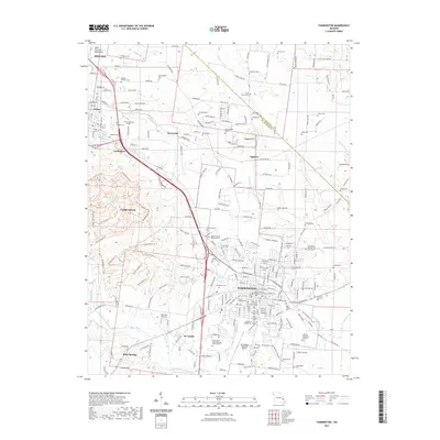
2021 Map of Farmington
USGS Topo · Published 2021About this map
The city of Farmington serves as the central hub of this Missouri survey, anchored by the Saint Francois County Courthouse and a dense concentration of local history markers. This 2021 landscape is characterized by a high density of cemeteries, including the Masonic Cem of Farmington and the Knights of Pythias Cem, which highlight the long-standing community roots in the region. Surrounding the urban center, the topography transitions toward the Saint Francois Mountains to the northwest, while the Saint Francois River and Wolf Creek drain the surrounding valley. Educational and medical infrastructure are prominent, with the Mineral Area College campus and the Farmington State Hospital Cem Number 4 situated near the city's western and southern reaches. Recreational trail networks, such as the Orv Trail System Trl and Enduro Race Trl near Park Hills, indicate the area's modern evolution into a destination for outdoor enthusiasts.
Find a feature on this map
243 named features on this map. Tap any name to fly to it.
Don’t see what you’re looking for? This feature index may not catch every label — zoom into the map to look around manually.
Map Details
Editions of this 2021 Farmington Map
This is the sole edition of this map. No revisions or reprints were ever made.
Other maps of this area

1904 · Farmington
USGS Topo · 1:62,500

1905 · Bonneterre
USGS Topo · 1:62,500

1906 · Farmington
USGS Topo · 1:62,500

1937 · Ironton
USGS Topo · 1:48,000

1939 · Fredericktown
USGS Topo · 1:48,000

1945 · Ironton
USGS Topo · 1:62,500

1946 · Ironton
USGS Topo · 1:62,500

1947 · Fredericktown
USGS Topo · 1:62,500

1949 · Rolla
USGS Topo · 1:250,000

1950 · Fredericktown
USGS Topo · 1:62,500