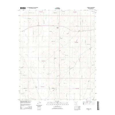
2014 Map of Farmville
USGS Topo · Published 2014About this map
Farmville and the nearby community of Craney anchor this southern Bradley County landscape, where timber and local agriculture define the local economy. The terrain is intricately drained by a network of waterways including Steepbank L'Aigle Cr, Beech Cr, and California Br, which weave through the townships. For genealogists, the map is particularly detailed, identifying numerous burial sites that serve as anchors for local family history, such as Ebenezer Cem, Parnell Cem, and Pleasant Valley Cem.
Find a feature on this map
69 named features on this map. Tap any name to fly to it.
Don’t see what you’re looking for? This feature index may not catch every label — zoom into the map to look around manually.
Map Details
Editions of this 2014 Farmville Map
This is the sole edition of this map. No revisions or reprints were ever made.
Other maps of this area

1934 · Ingalls
USGS Topo · 1:48,000

1934 · Moro Bay
USGS Topo · 1:62,500

1937 · Ingalls
USGS Topo · 1:62,500

1938 · Moro Bay
USGS Topo · 1:62,500

1939 · Moro Bay
USGS Topo · 1:62,500

1939 · Ingalls
USGS Topo · 1:62,500

1953 · El Dorado
USGS Topo · 1:250,000

1957 · El Dorado
USGS Topo · 1:250,000

1958 · El Dorado
USGS Topo · 1:250,000

1960 · El Dorado
USGS Topo · 1:250,000