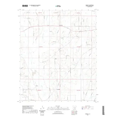
2020 Map of Farmville
USGS Topo · Published 2020About this map
Cross Roads, Craney, and Farmville center this portrait of Bradley County, Arkansas, where the landscape is defined by the branching tributaries of the L’Aigle Creek system. The map reveals a high density of rural burial grounds, including the Crossroads Cem, Parnell Cem, and Pleasant Valley Cem, providing essential location data for genealogists and local historians. The creek network, featuring Steepbank L'Aigle Cr, Beech Cr, and California Br, dictates the winding paths of local roads such as Pleasant Valley Rd and Castleberry King. This modern survey documents the persistence of small family-named landmarks and historical community hubs in the southern Arkansas pinewoods, where land management is still organized along traditional township and range lines.
Find a feature on this map
76 named features on this map. Tap any name to fly to it.
Don’t see what you’re looking for? This feature index may not catch every label — zoom into the map to look around manually.
Map Details
Editions of this 2020 Farmville Map
This is the sole edition of this map. No revisions or reprints were ever made.
Other maps of this area

1934 · Ingalls
USGS Topo · 1:48,000

1934 · Moro Bay
USGS Topo · 1:62,500

1937 · Ingalls
USGS Topo · 1:62,500

1938 · Moro Bay
USGS Topo · 1:62,500

1939 · Moro Bay
USGS Topo · 1:62,500

1939 · Ingalls
USGS Topo · 1:62,500

1953 · El Dorado
USGS Topo · 1:250,000

1957 · El Dorado
USGS Topo · 1:250,000

1958 · El Dorado
USGS Topo · 1:250,000

1960 · El Dorado
USGS Topo · 1:250,000