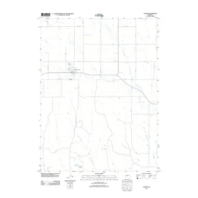
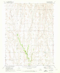
2011 Map of Farnam
USGS Topo · Published 2011About this map
Farnam sits at the intersection of local routes in this part of Dawson County, characterized by a structured grid of rural roads and essential water management. The community is anchored by the Farnam Post Office and the nearby Farnam Cemetery, reflecting the enduring civic and social foundations of the area. The landscape is defined by the drainage patterns of North Plum Creek and West Muddy Creek, which feed into local infrastructure such as the Farnam Reservoir and Gardner Reservoir. These features, supported by the Farnam Dam and Gardner Dam, illustrate the critical role of water storage in supporting the agricultural economy of the Nebraska plains. The map's detailed road network, including S Peckham RD and S Coline RD, highlights the connectivity between isolated farmsteads and the central village, providing a clear record of the region's 21st-century rural character.
Find a feature on this map
23 named features on this map. Tap any name to fly to it.
Don’t see what you’re looking for? This feature index may not catch every label — zoom into the map to look around manually.
Map Details
Editions of this 2011 Farnam Map
This is the sole edition of this map. No revisions or reprints were ever made.
Other maps of this area

1902 · Gothenburg
USGS Topo · 1:125,000

1954 · McCook
USGS Topo · 1:250,000

1956 · Stockville NE
USGS Topo · 1:24,000

1956 · Stockville SE
USGS Topo · 1:24,000

1957 · McCook
USGS Topo · 1:250,000

1958 · McCook
USGS Topo · 1:250,000
1970 · Eustis SW
USGS Topo · 1:24,000
1970 · Eustis
USGS Topo · 1:24,000
1970 · Jeffrey Reservoir SE
USGS Topo · 1:24,000
1970 · Eustis SE
USGS Topo · 1:24,000