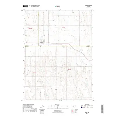
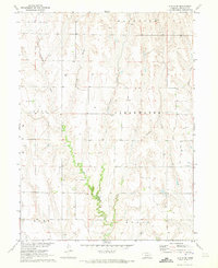
2017 Map of Farnam
USGS Topo · Published 2017About this map
Farnam sits at the intersection of Dawson, Lincoln, and Frontier counties, serving as a vital central point for the surrounding agricultural plains. This survey documents the complex drainage systems that define the local topography, characterized by deep incisions like Midway Canyon and Horseshoe Canyon that break up the high prairie. The landscape is heavily managed for water, featuring the Farnam Reservoir and Gardner Reservoir, which support the region's farming economy. The village layout is clearly visible with its grid of streets such as Main St and Lincoln St, while the nearby Farnam Cem provides a focal point for genealogical research. The map tracks the winding courses of Plum Cr and W Muddy Cr, illustrating how these waterways dictated the early placement of roads and property boundaries across the Nebraska countryside.
Find a feature on this map
34 named features on this map. Tap any name to fly to it.
Don’t see what you’re looking for? This feature index may not catch every label — zoom into the map to look around manually.
Map Details
Editions of this 2017 Farnam Map
This is the sole edition of this map. No revisions or reprints were ever made.
Other maps of this area

1902 · Gothenburg
USGS Topo · 1:125,000

1954 · McCook
USGS Topo · 1:250,000

1956 · Stockville NE
USGS Topo · 1:24,000

1956 · Stockville SE
USGS Topo · 1:24,000

1957 · McCook
USGS Topo · 1:250,000

1958 · McCook
USGS Topo · 1:250,000
1970 · Eustis SW
USGS Topo · 1:24,000
1970 · Eustis
USGS Topo · 1:24,000
1970 · Jeffrey Reservoir SE
USGS Topo · 1:24,000
1970 · Eustis SE
USGS Topo · 1:24,000