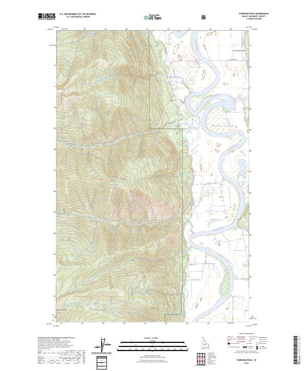
2024 Map of Farnham Peak
USGS Topo · Published 2024About this map
Farnham Peak stands as the dominant topographical landmark in this northern Idaho survey, marking the western heights above the Kootenai River. The landscape is sharply divided between the timbered slopes of the Kaniksu National Forest and the broad, alluvial floor of the Purcell Trench. Along the river's winding course, complex wetland patterns and old oxbows indicate a dynamic hydrological history, even as the valley floor is segmented by rural routes like W Side Rd and Loop Rd.
Find a feature on this map
41 named features on this map. Tap any name to fly to it.
Don’t see what you’re looking for? This feature index may not catch every label — zoom into the map to look around manually.
Map Details
Editions of this 2024 Farnham Peak Map
This is the sole edition of this map. No revisions or reprints were ever made.
Other maps of this area

1911 · Priest Lake
USGS Topo · 1:250,000

1913 · Priest Lake
USGS Topo · 1:250,000

1958 · Sandpoint
USGS Topo · 1:250,000

1963 · Sandpoint
USGS Topo · 1:250,000

1965 · Farnham Peak
USGS Topo · 1:24,000

1965 · Moravia
USGS Topo · 1:24,000

1965 · Ritz
USGS Topo · 1:24,000

1965 · Copeland
USGS Topo · 1:24,000

1965 · Hall Mountain
USGS Topo · 1:24,000
1965 · Bonners Ferry
USGS Topo · 1:24,000