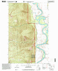
1996 Map of Farnham Peak
USGS Topo · Published 1999About this map
Kootenai River defines the eastern valley of this northern Idaho landscape, snaking through agricultural bottomlands where a grain elevator and several pumping stations stand at the edge of the water. The settlement at Camp 5 marks the northern extent of the river plain on this sheet, just before the terrain rises sharply into the protected wilderness of Kaniksu National Forest. The transition from the flat river basin to the high-elevation peaks is abrupt, as the land climbs toward Farnham Peak and Burton Peak.
Find a feature on this map
24 named features on this map. Tap any name to fly to it.
Don’t see what you’re looking for? This feature index may not catch every label — zoom into the map to look around manually.
Map Details
Editions of this 1996 Farnham Peak Map
This is the sole edition of this map. No revisions or reprints were ever made.
Other maps of this area

1911 · Priest Lake
USGS Topo · 1:250,000

1913 · Priest Lake
USGS Topo · 1:250,000

1958 · Sandpoint
USGS Topo · 1:250,000

1963 · Sandpoint
USGS Topo · 1:250,000

1965 · Farnham Peak
USGS Topo · 1:24,000

1965 · Moravia
USGS Topo · 1:24,000

1965 · Ritz
USGS Topo · 1:24,000

1965 · Copeland
USGS Topo · 1:24,000

1965 · Hall Mountain
USGS Topo · 1:24,000
1965 · Bonners Ferry
USGS Topo · 1:24,000