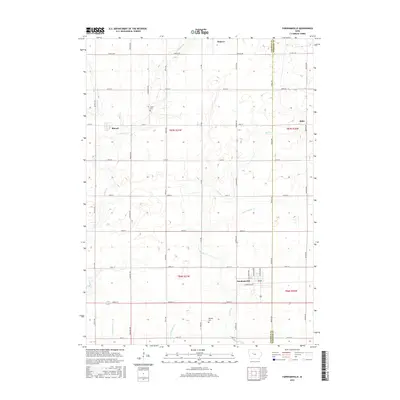
2015 Map of Farnhamville
USGS Topo · Published 2015About this map
Farnhamville and the surrounding townships of Calhoun and Webster counties are captured here at a moment of agricultural maturity. The landscape is a testament to the extensive drainage projects required for the region's productivity, clearly illustrated by engineered waterways like Ditch Number 12 and Ditch Number 28. These artificial channels supplement the natural flow of Hardin Cr and Reading Cr, creating a highly modified and efficient prairie grid.
Find a feature on this map
43 named features on this map. Tap any name to fly to it.
Don’t see what you’re looking for? This feature index may not catch every label — zoom into the map to look around manually.
Map Details
Editions of this 2015 Farnhamville Map
This is the sole edition of this map. No revisions or reprints were ever made.
Other maps of this area

1954 · Fort Dodge
USGS Topo · 1:250,000

1957 · Fort Dodge
USGS Topo · 1:250,000

1958 · Fort Dodge
USGS Topo · 1:250,000

1962 · Jefferson
USGS Topo · 1:62,500

1965 · Moorland
USGS Topo · 1:24,000

1965 · Farnhamville
USGS Topo · 1:24,000

1965 · Knierim
USGS Topo · 1:24,000

1965 · Gowrie
USGS Topo · 1:24,000

1980 · Wightman
USGS Topo · 1:24,000
1980 · Richard
USGS Topo · 1:24,000