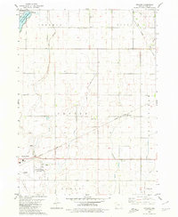
1980 Map of Richard
USGS Topo · Published 1980About this map
Rockwell City and its surrounding townships define this 1980 survey, which documents a structured landscape of agriculture and civic infrastructure in Calhoun County. The map provides a detailed look at the State Reformatory For Women and the Municipal Airport on the city's outskirts, as well as the transition from urban streets to sectioned farmland. To the north, Twin Lakes State Park and North Twin Lake serve as primary recreational points, while the small settlement of Richard sits along the Illinois Central Gulf railroad tracks. Genealogists will find notable value in the precisely marked locations of Rosehill Cem, Hope Cem, and Leith Cem. The terrain is characterized by a series of drainage projects, including numerous Ditches feeding into Purgatory Creek and West Cedar Creek, illustrating the extensive water management required for regional farming.
Find a feature on this map
34 named features on this map. Tap any name to fly to it.
Don’t see what you’re looking for? This feature index may not catch every label — zoom into the map to look around manually.
Map Details
Editions of this 1980 Richard Map
This is the sole edition of this map. No revisions or reprints were ever made.
Other maps of this area

1954 · Fort Dodge
USGS Topo · 1:250,000

1957 · Fort Dodge
USGS Topo · 1:250,000

1958 · Fort Dodge
USGS Topo · 1:250,000

1965 · Farnhamville
USGS Topo · 1:24,000

1965 · Knierim
USGS Topo · 1:24,000

1979 · Gilmore City SW
USGS Topo · 1:24,000

1979 · Manson
USGS Topo · 1:24,000

1979 · Pomeroy
USGS Topo · 1:24,000

1980 · Rockwell City
USGS Topo · 1:24,000
1980 · Lohrville
USGS Topo · 1:24,000