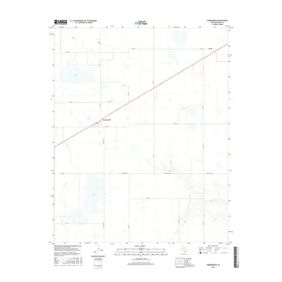
2016 Map of Farnsworth
USGS Topo · Published 2016About this map
Farnsworth and the small settlement of Lord anchor this section of Ochiltree County in the northern Texas Panhandle. The landscape is defined by the high plains' characteristic drainage patterns, specifically the winding course of Wolf Cr as it carves through the southeast. A network of straight-line section roads, including Co Rd 11 and Co Rd 7, overlays the territory, illustrating the rigid grid of rural land division. Significant water features such as Truax Lake and Deer Lake stand out against the surrounding terrain, providing crucial landmarks in this agricultural region. The mapping of Ranch Rd 3045 and Ranch Rd 376 highlights the modern transportation routes that replaced earlier wagon paths, connecting these remote ranching and farming communities to the wider Panhandle economy.
Find a feature on this map
18 named features on this map. Tap any name to fly to it.
Don’t see what you’re looking for? This feature index may not catch every label — zoom into the map to look around manually.
Map Details
Editions of this 2016 Farnsworth Map
This is the sole edition of this map. No revisions or reprints were ever made.
Other maps of this area

1954 · Perryton
USGS Topo · 1:250,000

1958 · Perryton
USGS Topo · 1:250,000

1973 · Farnsworth
USGS Topo · 1:24,000

1973 · Horseshoe Hill
USGS Topo · 1:24,000

1973 · Sourdough Creek NE
USGS Topo · 1:24,000

1973 · Perryton SE
USGS Topo · 1:24,000

1973 · Perryton
USGS Topo · 1:24,000

1973 · Waka
USGS Topo · 1:24,000

1973 · Spearman NE
USGS Topo · 1:24,000

1973 · Sourdough Creek NW
USGS Topo · 1:24,000