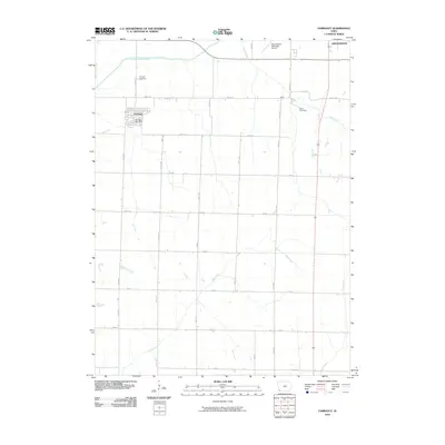
2010 Map of Farragut
USGS Topo · Published 2010About this map
Farragut and the surrounding agricultural landscape of Page County are documented here during the first decade of the 21st century. The map illustrates a grid of section-line roads, such as Manti Rd and Co Rd J40, that define the local grain-farming economy. The East Nishnabotna River cuts across the northwest corner, while numerous smaller drainages like Fisher Creek and Mill Creek weave through the fields, influencing the placement of homesteads and small settlements.
Find a feature on this map
32 named features on this map. Tap any name to fly to it.
Don’t see what you’re looking for? This feature index may not catch every label — zoom into the map to look around manually.
Map Details
Editions of this 2010 Farragut Map
This is the sole edition of this map. No revisions or reprints were ever made.
Other maps of this area

1939 · Farragut
USGS Topo · 1:62,500

1939 · Hamburg
USGS Topo · 1:62,500

1940 · Farragut
USGS Topo · 1:62,500

1941 · Hamburg
USGS Topo · 1:62,500

1955 · Nebraska City
USGS Topo · 1:250,000

1957 · Nebraska City
USGS Topo · 1:250,000

1957 · Randolph
USGS Topo · 1:24,000

1958 · Nebraska City
USGS Topo · 1:250,000

1978 · Shenandoah East
USGS Topo · 1:24,000
1978 · Shenandoah West
USGS Topo · 1:24,000