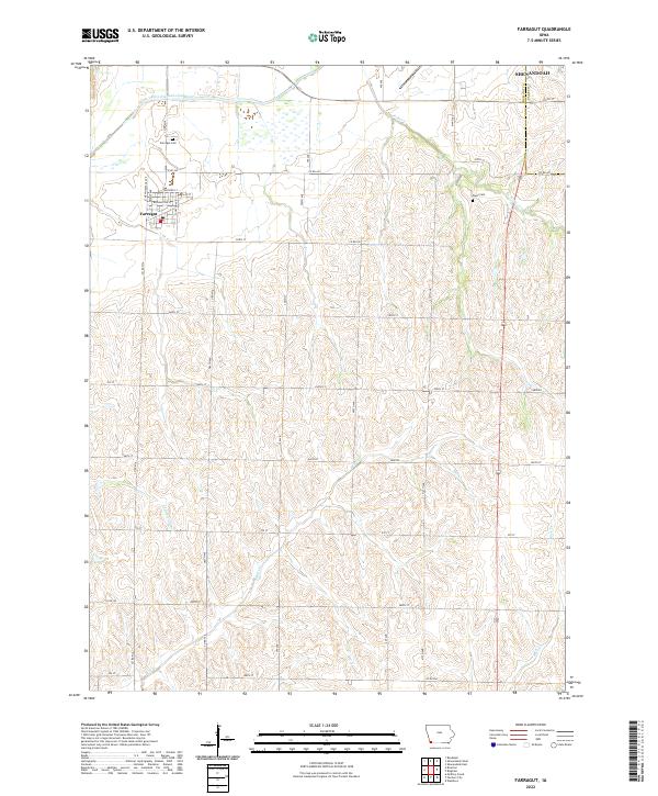
2022 Map of Farragut
USGS Topo · Published 2022About this map
The town of Farragut sits at the intersection of New Orleans Ave and Co Rd J40 in Fremont County, serving as a hub for the surrounding agricultural prairie. This 2022 survey details the grid of the village, including the local Post Office and streets like Washington St and Clay St. Just north of the settlement lies the Farragut Cem, while the historic Manti Cem is situated to the east near the Page County line, providing valuable locations for genealogical research.
Find a feature on this map
41 named features on this map. Tap any name to fly to it.
Don’t see what you’re looking for? This feature index may not catch every label — zoom into the map to look around manually.
Map Details
Editions of this 2022 Farragut Map
This is the sole edition of this map. No revisions or reprints were ever made.
Other maps of this area

1939 · Farragut
USGS Topo · 1:62,500

1939 · Hamburg
USGS Topo · 1:62,500

1940 · Farragut
USGS Topo · 1:62,500

1941 · Hamburg
USGS Topo · 1:62,500

1955 · Nebraska City
USGS Topo · 1:250,000

1957 · Nebraska City
USGS Topo · 1:250,000

1957 · Randolph
USGS Topo · 1:24,000

1958 · Nebraska City
USGS Topo · 1:250,000

1978 · Shenandoah East
USGS Topo · 1:24,000
1978 · Shenandoah West
USGS Topo · 1:24,000