
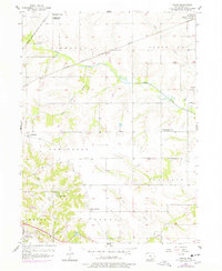
1956 Map of Farson
USGS Topo · Published 1958About this map
Highland Center and the small unincorporated settlement of Farson anchor this rural landscape in the mid-1950s, a period when the local educational system was undergoing significant consolidation. This transition is clearly visible through the numerous decommissioned rural schoolhouses dotting the townships, including Highland Sch, Nasby Sch, Pleasant Grove Sch, and Crossroads Sch. Only Round Point Sch remains labeled as an active educational site during this field check.
Find a feature on this map
25 named features on this map. Tap any name to fly to it.
Don’t see what you’re looking for? This feature index may not catch every label — zoom into the map to look around manually.
Map Details
Editions of this 1956 Farson Map
2 editions found
Other maps of this area

1954 · Centerville
USGS Topo · 1:250,000

1954 · Des Moines
USGS Topo · 1:250,000

1956 · Des Moines
USGS Topo · 1:250,000

1956 · Agency
USGS Topo · 1:24,000

1956 · Ottumwa North
USGS Topo · 1:62,500

1956 · Ottumwa South
USGS Topo · 1:24,000

1956 · Ottumwa South
USGS Topo · 1:62,500

1956 · Ottumwa North
USGS Topo · 1:24,000

1957 · Des Moines
USGS Topo · 1:250,000

1957 · Centerville
USGS Topo · 1:250,000