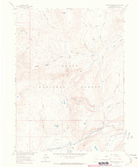
1962 Map of Farwell Mountain
USGS Topo · Published 1964About this map
Routt National Forest dominates this mountain landscape, which was meticulously field checked in the early 1960s. The area is characterized by high-elevation landmarks such as Farwell Mountain and Dome Peak, with drainage systems feeding into the Elk River. Human activity is concentrated along the river corridor and the diverse parks, including Diamond Park and Hinman Park. The map documents a primitive transportation network of pack trails and jeep paths, specifically the Three Island Lake Trail (Pack) and the North Elk Lake Trail (Pack), which served as vital access points for forest management and recreation. Remote outposts like the Seedhouse Guard Station and established campsites such as Seedhouse Campground highlight the area's role as a managed wilderness and recreational hub during the mid-20th century.
Find a feature on this map
34 named features on this map. Tap any name to fly to it.
Don’t see what you’re looking for? This feature index may not catch every label — zoom into the map to look around manually.
Map Details
Editions of this 1962 Farwell Mountain Map
3 editions found
Other maps of this area

1911 · Hahns Peak
USGS Topo · 1:125,000

1913 · Hahns Peak
USGS Topo · 1:125,000

1954 · Craig
USGS Topo · 1:250,000

1955 · Davis Peak
USGS Topo · 1:24,000

1955 · Mount Zirkel
USGS Topo · 1:24,000

1955 · Mount Ethel
USGS Topo · 1:24,000

1955 · Mount Ethel
USGS Topo · 1:62,500

1956 · Pearl
USGS Topo · 1:62,500

1957 · Craig
USGS Topo · 1:250,000

1958 · Craig
USGS Topo · 1:250,000