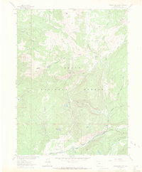
1962 Map of Farwell Mountain
USGS Topo · Published 1971About this map
Farwell Mountain dominates this portion of the Routt National Forest, rising above a complex network of glacial valleys and drainage basins. The landscape is defined by the convergence of the Middle Fork, North Fork, and South Fork of the Elk River, which meet near the established administrative and recreational hub at Seedhouse Guard Station. This area served as a critical node for forest management and high-country access in the early 1960s.
Find a feature on this map
31 named features on this map. Tap any name to fly to it.
Don’t see what you’re looking for? This feature index may not catch every label — zoom into the map to look around manually.
Map Details
Editions of this 1962 Farwell Mountain Map
3 editions found
Other maps of this area

1911 · Hahns Peak
USGS Topo · 1:125,000

1913 · Hahns Peak
USGS Topo · 1:125,000

1954 · Craig
USGS Topo · 1:250,000

1955 · Davis Peak
USGS Topo · 1:24,000

1955 · Mount Zirkel
USGS Topo · 1:24,000

1955 · Mount Ethel
USGS Topo · 1:24,000

1955 · Mount Ethel
USGS Topo · 1:62,500

1956 · Pearl
USGS Topo · 1:62,500

1957 · Craig
USGS Topo · 1:250,000

1958 · Craig
USGS Topo · 1:250,000