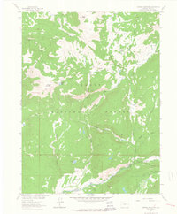
1962 Map of Farwell Mountain
USGS Topo · Published 1964About this map
Routt National Forest dominates this high-altitude landscape in northern Colorado, centered on the prominent peak of Farwell Mountain and the headwaters of the Elk River. The drainage patterns here are remarkably complex, with numerous waterways like Silver City Creek and King Solomon Creek carving through the terrain to feed the river's various forks. This 1962 survey documents a backcountry region defined by its lack of established roads, relying instead on a network of jeep trails and specialized routes like the Three Island Lake Trail (Pack). Human presence is concentrated at the Seedhouse Guard Station near the confluence of the North Fork Elk River and the Middle Fork, marking a transition between the lower parklands such as Boulder Park and the steep, alpine environments surrounding Dome Peak.
Find a feature on this map
31 named features on this map. Tap any name to fly to it.
Don’t see what you’re looking for? This feature index may not catch every label — zoom into the map to look around manually.
Map Details
Editions of this 1962 Farwell Mountain Map
3 editions found
Other maps of this area

1911 · Hahns Peak
USGS Topo · 1:125,000

1913 · Hahns Peak
USGS Topo · 1:125,000

1954 · Craig
USGS Topo · 1:250,000

1955 · Davis Peak
USGS Topo · 1:24,000

1955 · Mount Zirkel
USGS Topo · 1:24,000

1955 · Mount Ethel
USGS Topo · 1:24,000

1955 · Mount Ethel
USGS Topo · 1:62,500

1956 · Pearl
USGS Topo · 1:62,500

1957 · Craig
USGS Topo · 1:250,000

1958 · Craig
USGS Topo · 1:250,000