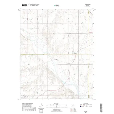
2018 Map of Fay
USGS Topo · Published 2018About this map
The Canadian River meanders across this landscape, defining the transition between Dewey, Blaine, and Custer Counties. The settlement of Fay serves as a focal point for the northern rural stretches, while the northern edge of Thomas appears at the southern map boundary. Between these two points, smaller historic locations such as Cody remain documented alongside essential community landmarks like Liberty Cem and Mount Hope Cem. The area is characterized by a dense grid of rural routes including e0830 RD and n2420 RD, which reveal the enduring section-line road system common to Oklahoma's agricultural heartland. This survey provides a clear view of the property divisions and local infrastructure as it existed in the late twenty-teens.
Find a feature on this map
30 named features on this map. Tap any name to fly to it.
Don’t see what you’re looking for? This feature index may not catch every label — zoom into the map to look around manually.
Map Details
Editions of this 2018 Fay Map
This is the sole edition of this map. No revisions or reprints were ever made.
Other maps of this area

1955 · Clinton
USGS Topo · 1:250,000

1957 · Clinton
USGS Topo · 1:250,000

1957 · Clinton
USGS Topo · 1:62,500

1962 · Putnam
USGS Topo · 1:62,500

1964 · Oakwood
USGS Topo · 1:62,500

1964 · Weatherford
USGS Topo · 1:62,500

1976 · Clinton NE
USGS Topo · 1:24,000
1983 · Clinton NE
USGS Topo · 1:24,000
1985 · Eagle City
USGS Topo · 1:24,000
1985 · Watonga
USGS Topo · 1:100,000