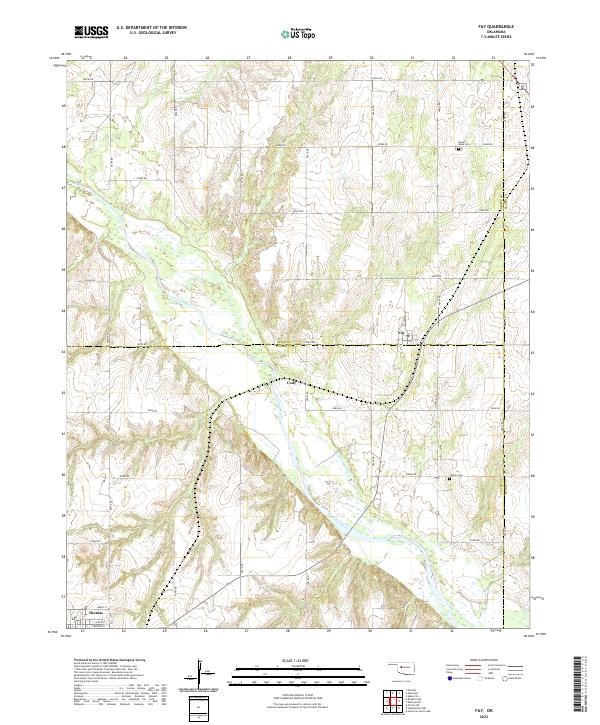
2022 Map of Fay
USGS Topo · Published 2022About this map
The Canadian River cuts diagonally through this landscape, marking the confluence of Dewey, Custer, and Blaine Counties. This section of the Oklahoma plains is defined by a grid of rural section roads like E0830 Rd and N2430 Rd that link small agricultural hubs. The settlement of Fay serves as a central point in this network, while the southern edge of the map reaches into the outskirts of Thomas, showing residential streets such as North St and E Roh St. Local history is preserved in the location of rural burial grounds, specifically Mount Hope Cem to the north and Liberty Cem near the river. The small community of Cody sits just south of the Dewey and Custer county line, illustrating the sparse but deliberate settlement pattern typical of this prairie region.
Find a feature on this map
30 named features on this map. Tap any name to fly to it.
Don’t see what you’re looking for? This feature index may not catch every label — zoom into the map to look around manually.
Map Details
Editions of this 2022 Fay Map
This is the sole edition of this map. No revisions or reprints were ever made.
Other maps of this area

1955 · Clinton
USGS Topo · 1:250,000

1957 · Clinton
USGS Topo · 1:250,000

1957 · Clinton
USGS Topo · 1:62,500

1962 · Putnam
USGS Topo · 1:62,500

1964 · Oakwood
USGS Topo · 1:62,500

1964 · Weatherford
USGS Topo · 1:62,500

1976 · Clinton NE
USGS Topo · 1:24,000
1983 · Clinton NE
USGS Topo · 1:24,000
1985 · Eagle City
USGS Topo · 1:24,000
1985 · Watonga
USGS Topo · 1:100,000