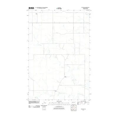
2011 Map of Fayette
USGS Topo · Published 2011About this map
The settlement of Fayette sits at the convergence of open prairie and a complex network of waterways in Dunn County. This area is defined by the winding paths of the Little Knife River and the Knife River, which dominate the southern half of the landscape. The map details a transition from the rolling plains to the riparian corridors that have historically shaped local ranching and agriculture. Notable for genealogists and local historians are the Haven of Rest Cemetery in the northwest corner and Saint Edwards Cemetery further south, both positioned near the section-line roads that grid the territory. The drainage pattern of Spring Creek in the northeast further illustrates the hydrological character of this North Dakota region, where life follows the erratic bends of the creek beds.
Find a feature on this map
17 named features on this map. Tap any name to fly to it.
Don’t see what you’re looking for? This feature index may not catch every label — zoom into the map to look around manually.
Map Details
Editions of this 2011 Fayette Map
This is the sole edition of this map. No revisions or reprints were ever made.
Other maps of this area

1953 · Watford City
USGS Topo · 1:250,000

1957 · Watford City
USGS Topo · 1:250,000

1963 · Hungry Man Butte
USGS Topo · 1:24,000

1967 · Watford City
USGS Topo · 1:250,000

1973 · Manning
USGS Topo · 1:24,000

1973 · Manning NW
USGS Topo · 1:24,000

1974 · Killdeer
USGS Topo · 1:100,000

1974 · Petes Creek
USGS Topo · 1:24,000

1974 · Fayette
USGS Topo · 1:24,000
1974 · Killdeer
USGS Topo · 1:24,000