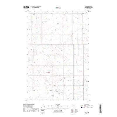
2017 Map of Fayette
USGS Topo · Published 2017About this map
Fayette is the primary settlement shown in this North Dakota landscape, situated near a southern bend of the Knife River. The surrounding topography is defined by the winding paths of the Little Knife River and Spring Cr, which carve through the plains of Dunn County. This 2017 survey reveals a grid of rural infrastructure, including 10M St SW and 117th Ave SW, that provides access to remote farmsteads and sections of land. Local heritage is preserved at two distinct burial grounds: Haven of Rest Cem in the northwestern portion of the map and Saint Edwards Cem further south. The map reflects the enduring rural character of the region, where the intersection of water courses and a structured road network supports the ranching and agricultural operations common to this part of the state.
Find a feature on this map
26 named features on this map. Tap any name to fly to it.
Don’t see what you’re looking for? This feature index may not catch every label — zoom into the map to look around manually.
Map Details
Editions of this 2017 Fayette Map
This is the sole edition of this map. No revisions or reprints were ever made.
Other maps of this area

1953 · Watford City
USGS Topo · 1:250,000

1957 · Watford City
USGS Topo · 1:250,000

1963 · Hungry Man Butte
USGS Topo · 1:24,000

1967 · Watford City
USGS Topo · 1:250,000

1973 · Manning
USGS Topo · 1:24,000

1973 · Manning NW
USGS Topo · 1:24,000

1974 · Killdeer
USGS Topo · 1:100,000

1974 · Petes Creek
USGS Topo · 1:24,000

1974 · Fayette
USGS Topo · 1:24,000
1974 · Killdeer
USGS Topo · 1:24,000