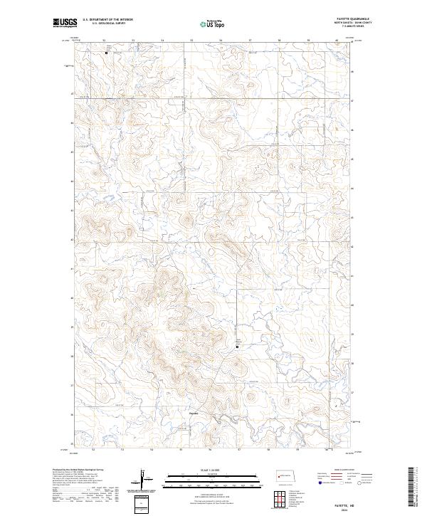
2024 Map of Fayette
USGS Topo · Published 2024About this map
Fayette stands as the primary namesake settlement in this northern portion of the Missouri Plateau, situated among the rolling breaks of the Spring Creek drainage. The landscape is characterized by its high-plains topography, where agricultural section lines intersect a terrain carved by several significant creek branches. This survey reflects the modern rural structure of Dunn County, highlighting how the contemporary road network follows the historic Public Land Survey System. The area remains a sparsely populated region of western North Dakota, where the economy is deeply tied to the land and the water sources that sustain it, such as Spring Creek in the northeastern reaches of the quadrangle.
Find a feature on this map
2 named features on this map. Tap any name to fly to it.
Don’t see what you’re looking for? This feature index may not catch every label — zoom into the map to look around manually.
Map Details
Editions of this 2024 Fayette Map
This is the sole edition of this map. No revisions or reprints were ever made.
Other maps of this area

1953 · Watford City
USGS Topo · 1:250,000

1957 · Watford City
USGS Topo · 1:250,000

1963 · Hungry Man Butte
USGS Topo · 1:24,000

1967 · Watford City
USGS Topo · 1:250,000

1973 · Manning
USGS Topo · 1:24,000

1973 · Manning NW
USGS Topo · 1:24,000

1974 · Killdeer
USGS Topo · 1:100,000

1974 · Petes Creek
USGS Topo · 1:24,000

1974 · Fayette
USGS Topo · 1:24,000
1974 · Killdeer
USGS Topo · 1:24,000