
1974 Map of Fayette
USGS Topo · Published 1977About this map
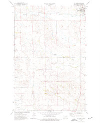
Fayette is situated along the winding course of the Little Knife River in this 1974 topographic record of Dunn County. The settlement patterns of this era are anchored by institutional landmarks such as St Edwards Ch and its namesake St Edwards Cem located to the south. Further north, the Haven of Rest Cem provides an additional point of interest for genealogists tracing local families. The landscape is marked by small-scale industrial activity, including several Scoria Pits and a Gravel Pit, reflecting the area's geological utility. The presence of a Drill Hole in the eastern section suggests a period of subsurface exploration common in this region of North Dakota during the mid-1970s.
Find a feature on this map
12 named features on this map. Tap any name to fly to it.
Don’t see what you’re looking for? This feature index may not catch every label — zoom into the map to look around manually.
Map Details
Editions of this 1974 Fayette Map
This is the sole edition of this map. No revisions or reprints were ever made.
Other maps of this area

1953 · Watford City
USGS Topo · 1:250,000

1957 · Watford City
USGS Topo · 1:250,000

1963 · Hungry Man Butte
USGS Topo · 1:24,000

1967 · Watford City
USGS Topo · 1:250,000

1973 · Manning
USGS Topo · 1:24,000

1973 · Manning NW
USGS Topo · 1:24,000

1974 · Killdeer
USGS Topo · 1:100,000

1974 · Petes Creek
USGS Topo · 1:24,000
1974 · Killdeer
USGS Topo · 1:24,000
1974 · Oakdale
USGS Topo · 1:24,000