
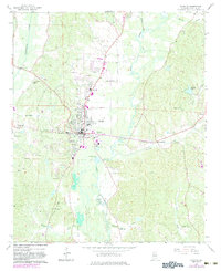
1967 Map of Fayette
USGS Topo · Published 1968About this map
Fayette serves as the focal point of this 1960s survey, showing a well-established county seat where the Southern railway intersects a landscape defined by the Sipsey River and Luxapallila Creek. The map documents a period of civic infrastructure, including the Fayette Municipal Airport, a WWWF Radio Tower, and the West Highland High Sch.
Find a feature on this map
48 named features on this map. Tap any name to fly to it.
Don’t see what you’re looking for? This feature index may not catch every label — zoom into the map to look around manually.
Map Details
Editions of this 1967 Fayette Map
2 editions found
Other maps of this area

1953 · Birmingham
USGS Topo · 1:250,000

1956 · Birmingham
USGS Topo · 1:250,000

1957 · Birmingham
USGS Topo · 1:250,000

1967 · Bankston
USGS Topo · 1:24,000

1967 · Winfield SE
USGS Topo · 1:24,000

1967 · Newtonville
USGS Topo · 1:24,000

1967 · Kennedy
USGS Topo · 1:24,000

1967 · Hubbertville
USGS Topo · 1:24,000

1967 · Bluff
USGS Topo · 1:24,000
1967 · New Lexington
USGS Topo · 1:24,000