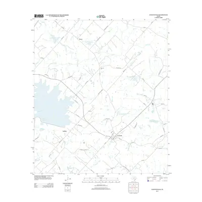
2013 Map of Fayetteville
USGS Topo · Published 2013About this map
Fayetteville serves as the central hub for this portion of Fayette County, characterized by its grid of streets including W Market St and S Scott St. The surrounding landscape is a network of small agricultural holdings and water management sites, evidenced by numerous small catchments like Soil Conservation Service Site 24 Reservoir and Soil Conservation Service Site 29 Reservoir. Family history is anchored in the rural landscape at Halimecek Cem and Eilers Cem, while smaller settlements like Roznov and Tamberg mark older community nodes. The western edge is dominated by the broad waters of Cedar Cr Reservoir, while drainage across the rest of the quadrangle is defined by winding tributaries such as Cummins Cr, Spencer Pool Cr, and Pool Br. To the east, the elevation rises slightly at Rek Hill, offering a view of the transition from creek-bottom land to the upland prairie and woods.
Find a feature on this map
68 named features on this map. Tap any name to fly to it.
Don’t see what you’re looking for? This feature index may not catch every label — zoom into the map to look around manually.
Map Details
Editions of this 2013 Fayetteville Map
This is the sole edition of this map. No revisions or reprints were ever made.
Other maps of this area

1919 · Fayettsville
USGS Topo · 1:62,500

1919 · Giddings
USGS Topo · 1:62,500

1953 · Seguin
USGS Topo · 1:250,000

1954 · Austin
USGS Topo · 1:250,000

1956 · La Grange
USGS Topo · 1:62,500

1957 · Ellinger
USGS Topo · 1:24,000

1957 · La Grange East
USGS Topo · 1:24,000

1957 · Ammannsville
USGS Topo · 1:24,000

1958 · Seguin
USGS Topo · 1:250,000

1958 · Industry
USGS Topo · 1:24,000