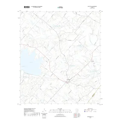
2019 Map of Fayetteville
USGS Topo · Published 2019About this map
Fayetteville serves as the focal point of this Fayette County landscape, situated near the headwaters of numerous creeks and the sprawling eastern shore of Lake Fayette. The settlement pattern reflects a deeply rooted rural community, with family-named landmarks such as Halimecek Cem and Ellers Cem providing valuable points of reference for local historians and genealogists. A complex network of Farm to Market roads, including FM 1291 and FM 955, connects the central town to the outlying settlement of Rek Hill.
Find a feature on this map
63 named features on this map. Tap any name to fly to it.
Don’t see what you’re looking for? This feature index may not catch every label — zoom into the map to look around manually.
Map Details
Editions of this 2019 Fayetteville Map
This is the sole edition of this map. No revisions or reprints were ever made.
Other maps of this area

1919 · Fayettsville
USGS Topo · 1:62,500

1919 · Giddings
USGS Topo · 1:62,500

1953 · Seguin
USGS Topo · 1:250,000

1954 · Austin
USGS Topo · 1:250,000

1956 · La Grange
USGS Topo · 1:62,500

1957 · Ellinger
USGS Topo · 1:24,000

1957 · La Grange East
USGS Topo · 1:24,000

1957 · Ammannsville
USGS Topo · 1:24,000

1958 · Seguin
USGS Topo · 1:250,000

1958 · Industry
USGS Topo · 1:24,000