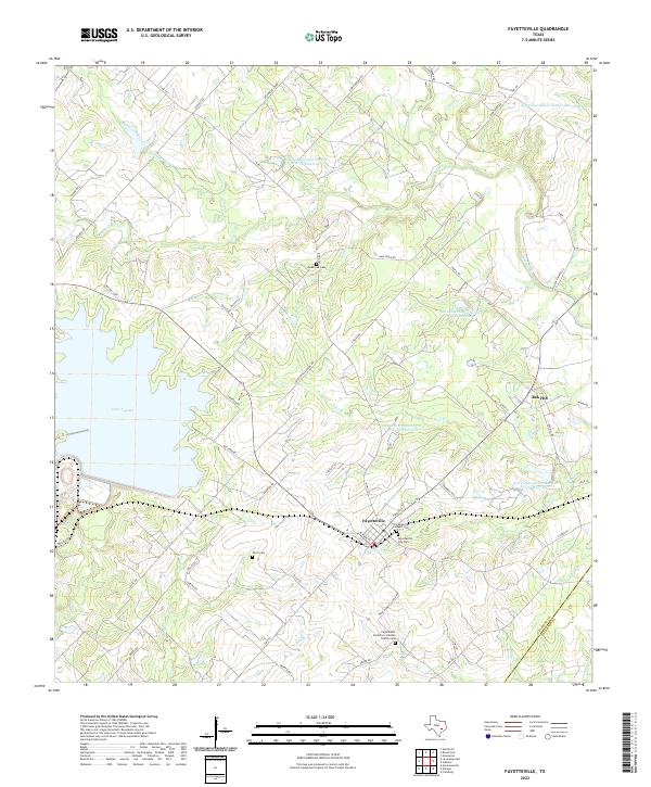
2022 Map of Fayetteville
USGS Topo · Published 2022About this map
Fayetteville sits as the central hub of this South Texas landscape, defined by a network of creeks and modern water management. The town's historical foundations are evident in the cluster of burial grounds including Fayetteville City Cem and the Fayetteville Catholic Cem. The surrounding terrain is drained by several waterways, most notably Cummins Cr and Allen Cr, while the expansive Lake Fayette dominates the western edge of the area.
Find a feature on this map
70 named features on this map. Tap any name to fly to it.
Don’t see what you’re looking for? This feature index may not catch every label — zoom into the map to look around manually.
Map Details
Editions of this 2022 Fayetteville Map
This is the sole edition of this map. No revisions or reprints were ever made.
Other maps of this area

1919 · Fayettsville
USGS Topo · 1:62,500

1919 · Giddings
USGS Topo · 1:62,500

1953 · Seguin
USGS Topo · 1:250,000

1954 · Austin
USGS Topo · 1:250,000

1956 · La Grange
USGS Topo · 1:62,500

1957 · Ellinger
USGS Topo · 1:24,000

1957 · La Grange East
USGS Topo · 1:24,000

1957 · Ammannsville
USGS Topo · 1:24,000

1958 · Seguin
USGS Topo · 1:250,000

1958 · Industry
USGS Topo · 1:24,000