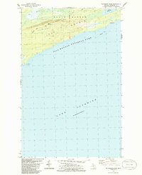
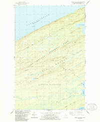
1985 Map of Feldtmann Ridge
USGS Topo · Published 1986About this map
Isle Royale National Park is defined by the sharp topographical rise of Feldtmann Ridge as it overlooks the expanse of Lake Superior. This 1985 mapping project, based on aerial revisions and 1984 field checks, reveals a landscape of high ridges and secluded waters on the island's southwestern reaches. The Feldtmann Lookout Tower serves as a primary navigational landmark atop the ridge, connected by the Feldtmann Trail which traverses the heights above Coyote Ridge. Along the northern edge, the Big Siskiwit River cuts through the lowlands, while the coast is marked by isolated points and hazards such as Long Point and McCormick Reef. The placement of Lake Halloran and Attwood Beach illustrates the varied coastal environment, from interior freshwater basins to the rocky beaches of the great lake.
Find a feature on this map
12 named features on this map. Tap any name to fly to it.
Don’t see what you’re looking for? This feature index may not catch every label — zoom into the map to look around manually.
Map Details
Editions of this 1985 Feldtmann Ridge Map
2 editions found
Other maps of this area

1958 · Hancock
USGS Topo · 1:250,000

1960 · Hancock
USGS Topo · 1:250,000

1961 · Hancock
USGS Topo · 1:250,000

1966 · Hancock
USGS Topo · 1:250,000

1985 · Siskiwit Bay
USGS Topo · 1:100,000

1985 · Grand Portage
USGS Topo · 1:100,000
1985 · Feldtmann Ridge
USGS Topo · 1:24,000
1985 · Feldtmann Lake
USGS Topo · 1:24,000
1985 · Windigo
USGS Topo · 1:24,000
1985 · Sugar Mountain
USGS Topo · 1:24,000