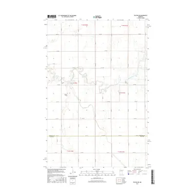
2016 Map of Felton NW
USGS Topo · Published 2016About this map
Wild Rice River meanders sharply across this agricultural landscape along the border of Norman and Clay Counties. The terrain is defined by its drainage patterns and a geometric grid of rural roads, including Co Rd 122 and Co Rd 6, which serve the outlying farms. The map preserves the locations of several community landmarks, specifically Bethania Lutheran Cem, Saint Marys Cem, and Landstad Cem. These sites, along with the course of Felton Cr, provide essential geographic markers for researchers tracking family lineages in the Red River Valley region. The map reflects a modern era of land management, showing the precise township and range divisions such as t143n r48w that have organized this section of Minnesota for generations.
Find a feature on this map
39 named features on this map. Tap any name to fly to it.
Don’t see what you’re looking for? This feature index may not catch every label — zoom into the map to look around manually.
Map Details
Editions of this 2016 Felton NW Map
This is the sole edition of this map. No revisions or reprints were ever made.
Other maps of this area

1918 · Hendrum
USGS Topo · 1:62,500

1924 · Ada
USGS Topo · 1:62,500

1952 · Grand Forks
USGS Topo · 1:250,000

1956 · Grand Forks
USGS Topo · 1:250,000

1963 · Georgetown
USGS Topo · 1:24,000

1963 · Perley
USGS Topo · 1:24,000

1963 · Halstad
USGS Topo · 1:24,000

1965 · Anthony
USGS Topo · 1:24,000
1965 · Ada
USGS Topo · 1:24,000

1966 · Grand Forks
USGS Topo · 1:250,000