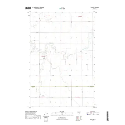
2019 Map of Felton NW
USGS Topo · Published 2019About this map
The Wild Rice River meanders through the northwest corner of the Red River Valley, defining the rural character of this northern Minnesota landscape. This 2019 survey captures the border between Norman Co and Clay Co, where the rectilinear grid of township roads meets the natural winding course of Felton Cr. For those tracing local heritage, the map identifies significant cultural sites including Saint Marys Cem, Bethania Lutheran Cem, and Landstad Cem, which remain as long-standing markers of the agricultural communities in this region. The landscape is primarily defined by its drainage patterns and vast agricultural sections, organized by historic survey lines that have dictated the region's development for over a century.
Find a feature on this map
27 named features on this map. Tap any name to fly to it.
Don’t see what you’re looking for? This feature index may not catch every label — zoom into the map to look around manually.
Map Details
Editions of this 2019 Felton NW Map
This is the sole edition of this map. No revisions or reprints were ever made.
Other maps of this area

1918 · Hendrum
USGS Topo · 1:62,500

1924 · Ada
USGS Topo · 1:62,500

1952 · Grand Forks
USGS Topo · 1:250,000

1956 · Grand Forks
USGS Topo · 1:250,000

1963 · Georgetown
USGS Topo · 1:24,000

1963 · Perley
USGS Topo · 1:24,000

1963 · Halstad
USGS Topo · 1:24,000

1965 · Anthony
USGS Topo · 1:24,000
1965 · Ada
USGS Topo · 1:24,000

1966 · Grand Forks
USGS Topo · 1:250,000