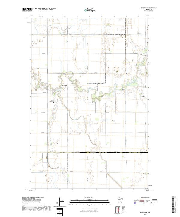
2022 Map of Felton NW
USGS Topo · Published 2022About this map
The winding Wild Rice River snakes across this agricultural landscape along the boundary of Norman County and Clay County. The terrain is defined by the tight meanders of the river and Felton Cr, which break up the rigid grid of section lines and gravel roads like Co Rd 185A and 160th Ave. For genealogists and local historians, the map is anchored by several established burial sites, including Saint Marys Cem near the riverbank and Bethania Lutheran Cem to the west. These landmarks, along with Landstad Cem, represent the enduring spiritual and community focal points for the rural families who have farmed this portion of the Red River Valley for generations.
Find a feature on this map
43 named features on this map. Tap any name to fly to it.
Don’t see what you’re looking for? This feature index may not catch every label — zoom into the map to look around manually.
Map Details
Editions of this 2022 Felton NW Map
This is the sole edition of this map. No revisions or reprints were ever made.
Other maps of this area

1918 · Hendrum
USGS Topo · 1:62,500

1924 · Ada
USGS Topo · 1:62,500

1952 · Grand Forks
USGS Topo · 1:250,000

1956 · Grand Forks
USGS Topo · 1:250,000

1963 · Georgetown
USGS Topo · 1:24,000

1963 · Perley
USGS Topo · 1:24,000

1963 · Halstad
USGS Topo · 1:24,000

1965 · Anthony
USGS Topo · 1:24,000
1965 · Ada
USGS Topo · 1:24,000

1966 · Grand Forks
USGS Topo · 1:250,000