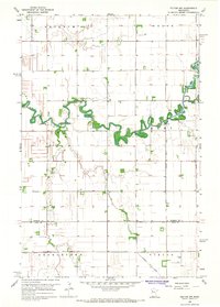
1966 Map of Felton NW
USGS Topo · Published 1967About this map
The Wild Rice River winds across this Red River Valley landscape, defining the character of the border between Norman and Clay Counties in the mid-1960s. The heavy concentration of drainage infrastructure, including Judicial Ditch No 56, County Ditch No 40, and County Ditch No 20, reveals the intensive engineering required to manage the flat prairie for agriculture. Local life is anchored by rural institutions like Landstad Ch and Bethania Ch, alongside St Marys Cem, which mark the centers of small townships such as Lee and Mary. The presence of a Townhall and a small Landing Strip highlights the community hubs and essential transportation infrastructure of this productive farming region.
Find a feature on this map
19 named features on this map. Tap any name to fly to it.
Don’t see what you’re looking for? This feature index may not catch every label — zoom into the map to look around manually.
Map Details
Editions of this 1966 Felton NW Map
This is the sole edition of this map. No revisions or reprints were ever made.
Other maps of this area

1918 · Hendrum
USGS Topo · 1:62,500

1924 · Ada
USGS Topo · 1:62,500

1952 · Grand Forks
USGS Topo · 1:250,000

1956 · Grand Forks
USGS Topo · 1:250,000

1963 · Georgetown
USGS Topo · 1:24,000

1963 · Perley
USGS Topo · 1:24,000

1963 · Halstad
USGS Topo · 1:24,000

1965 · Anthony
USGS Topo · 1:24,000
1965 · Ada
USGS Topo · 1:24,000

1966 · Grand Forks
USGS Topo · 1:250,000