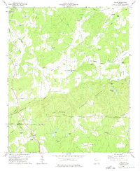
1973 Map of Felton
USGS Topo · Published 1975About this map
Felton sits along the southern edge of this 1970s survey, marking a small community hub at the junction of the Central of Georgia railroad and local rural routes. The landscape is defined by the significant ridges of Dugdown Mountain and Hightower Mountain, which dictate the paths of waterways like Cedar Creek and Fish Creek. Industrial activity is evident through numerous quarries scattered near Antioch and the Seaboard Coast Line tracks in the north.
Find a feature on this map
46 named features on this map. Tap any name to fly to it.
Don’t see what you’re looking for? This feature index may not catch every label — zoom into the map to look around manually.
Map Details
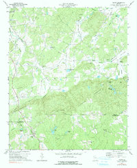
Editions of this 1973 Felton Map
2 editions found
Other maps of this area

1886 · Rome
USGS Topo · 1:125,000

1889 · Tallapoosa
USGS Topo · 1:125,000

1892 · Tallapoosa
USGS Topo · 1:125,000

1897 · Tallapoosa
USGS Topo · 1:125,000

1898 · Rome
USGS Topo · 1:125,000

1899 · Rome
USGS Topo · 1:125,000

1904 · Rome
USGS Topo · 1:125,000

1953 · Atlanta
USGS Topo · 1:250,000

1955 · Rome
USGS Topo · 1:250,000

1957 · Atlanta
USGS Topo · 1:250,000