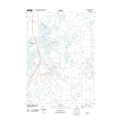
2011 Map of Fenton
USGS Topo · Published 2011About this map
Fenton and Holly anchor this landscape defined by a dense network of glacial lakes and the winding Shiawassee River. The area's mid-century development is visible through the Loon Lake Manufactured Home Community and the suburban expansion between the historic downtowns. This survey is particularly useful for genealogical research, documenting several burial sites including the Fenton Township Cemetery, Oakwood Cemetery, and Oak Hill Cemetery. Recreational and community hubs like Camp Copneconic and Guardian Angel Camp reflect the region's long-standing draw for summer gatherings. From the residential clusters at Lakeside to the quiet waters of Seven Lakes and Lake Iroquois, the map illustrates a transition from established municipal centers to water-centered residential and recreational zones at the start of the 21st century.
Find a feature on this map
154 named features on this map. Tap any name to fly to it.
Don’t see what you’re looking for? This feature index may not catch every label — zoom into the map to look around manually.
Map Details
Editions of this 2011 Fenton Map
This is the sole edition of this map. No revisions or reprints were ever made.
Other maps of this area

1907 · Howell
USGS Topo · 1:62,500

1909 · Howell
USGS Topo · 1:62,500

1909 · Milford
USGS Topo · 1:62,500

1920 · Holly
USGS Topo · 1:62,500

1922 · Holly
USGS Topo · 1:62,500

1922 · Durand
USGS Topo · 1:62,500

1936 · Highland
USGS Topo · 1:31,680

1942 · Highland
USGS Topo · 1:24,000

1943 · Holly
USGS Topo · 1:62,500

1943 · Durand
USGS Topo · 1:62,500