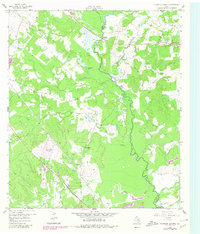
1959 Map of Ferguson Crossing
USGS Topo · Published 1980About this map
The Navasota River meanders along the boundary of Brazos and Grimes counties, anchoring a landscape defined by its riparian woodlands and winding tributaries like Wickson Creek and Panther Creek. Originally surveyed in the late 1950s and updated with 1980 photorevisions, the map documents the transition of this rural Brazos Valley terrain. The eponymous Ferguson Crossing sits at a strategic point on the river, while the surrounding area is dotted with oxbow lakes and local landmarks such as Tonkaway Lake and Brushy Lake.
Find a feature on this map
23 named features on this map. Tap any name to fly to it.
Don’t see what you’re looking for? This feature index may not catch every label — zoom into the map to look around manually.
Map Details
Editions of this 1959 Ferguson Crossing Map

Other maps of this area

1913 · Millican
USGS Topo · 1:31,680

1914 · Gay Hill
USGS Topo · 1:62,500

1914 · Navasota
USGS Topo · 1:62,500

1954 · Austin
USGS Topo · 1:250,000

1956 · Bryan
USGS Topo · 1:62,500

1956 · Carlos
USGS Topo · 1:62,500

1958 · Navasota
USGS Topo · 1:24,000

1959 · Millican
USGS Topo · 1:24,000

1959 · Clay
USGS Topo · 1:24,000

1959 · Reliance
USGS Topo · 1:24,000