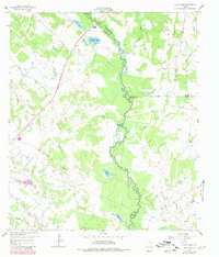
1959 Map of Clear Lake
USGS Topo · Published 1980About this map
The Navasota River meanders south through this Central Texas landscape, serving as the primary geographic border between Brazos, Madison, and Grimes counties. The river valley is a complex network of seasonal water features including Caney Slough, Brushy Lake, and Holl Lake, while Three Bridges and Democrat Crossing mark historic transit points across the shifting waterway. These crossing names and the presence of the Gaging Sta underscore the river's central role in local movement and water management during this era.
Find a feature on this map
32 named features on this map. Tap any name to fly to it.
Don’t see what you’re looking for? This feature index may not catch every label — zoom into the map to look around manually.
Map Details
Editions of this 1959 Clear Lake Map
3 editions found
Other maps of this area

1925 · Iola No 2
USGS Topo · 1:48,000

1931 · Iola
USGS Topo · 1:62,500

1954 · Austin
USGS Topo · 1:250,000

1956 · Bryan
USGS Topo · 1:62,500

1956 · Carlos
USGS Topo · 1:62,500

1959 · Clear Lake
USGS Topo · 1:24,000

1959 · Reliance
USGS Topo · 1:24,000

1962 · Edge
USGS Topo · 1:24,000

1962 · Keith
USGS Topo · 1:24,000

1962 · Bryan East
USGS Topo · 1:24,000