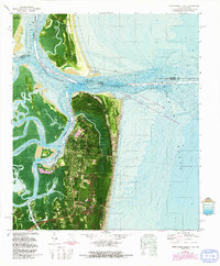
1981 Map of Fernandina Beach
USGS Topo · Published 1992About this map
Fort Clinch stands at the northern tip of Amelia Island, guarding the St Marys Entrance where the Atlantic Ocean meets the complex network of the St Marys River and Cumberland Sound. This orthophotomap, based on early 1970s imagery with 1990s revisions, reveals the industrial and maritime layout of Fernandina Beach. The urban grid transitions from the historic Old Fernandina site toward more modern developments in Southside. Local landmarks like the Amelia Island Lighthouse and Hardee Sch are visible alongside significant shipping infrastructure, including the Intracostal Waterway and a large industrial Conveyor system near the riverfront. Across the water to the north, the map details the southern edge of Cumberland Island at Dungeness and the massive dredging and pier layouts of the Kings Bay Naval Submarine Support Base, illustrating the strategic military and commercial importance of these Georgia-Florida border waters.
Find a feature on this map
34 named features on this map. Tap any name to fly to it.
Don’t see what you’re looking for? This feature index may not catch every label — zoom into the map to look around manually.
Map Details
Editions of this 1981 Fernandina Beach Map
4 editions found
Other maps of this area

1918 · St Marys
USGS Topo · 1:62,500

1918 · Cumberland Island
USGS Topo · 1:62,500

1918 · Kingsland
USGS Topo · 1:62,500

1919 · Fernandina
USGS Topo · 1:62,500

1919 · St Marys
USGS Topo · 1:62,500

1930 · Cumberland Island
USGS Topo · 1:62,500

1944 · Fernandina
USGS Topo · 1:62,500

1945 · Cumberland Island
USGS Topo · 1:62,500

1948 · Jacksonville
USGS Topo · 1:250,000

1957 · Jacksonville
USGS Topo · 1:250,000