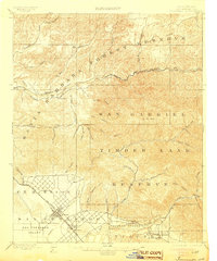
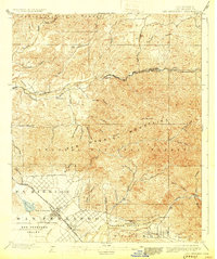
1900 Map of Fernando
USGS Topo · Published 1905About this map
The Ex Mission San Fernando boundary dominates the southern portion of this late 19th-century survey, anchoring the developing agricultural landscape of the San Fernando Valley. At the foot of the Santa Susana Mountains, the settlement of Fernando serves as a central hub, notably featuring the San Fernando Mission. This era reveals the critical role of transportation in the valley's growth, with the Southern Pacific RR carving a path through the terrain.
Find a feature on this map
54 named features on this map. Tap any name to fly to it.
Don’t see what you’re looking for? This feature index may not catch every label — zoom into the map to look around manually.
Map Details
Editions of this 1900 Fernando Map
6 editions found
Other maps of this area

1894 · Los Angeles
USGS Topo · 1:62,500

1896 · Pasadena
USGS Topo · 1:62,500

1896 · Santa Monica
USGS Topo · 1:62,500

1898 · Santa Monica
USGS Topo · 1:62,500

1900 · Pasadena
USGS Topo · 1:62,500

1900 · Tujunga
USGS Topo · 1:62,500

1900 · Los Angeles
USGS Topo · 1:62,500

1900 · Fernando
USGS Topo · 1:62,500

1901 · Southern California Sheet No. 1
USGS Topo · 1:250,000

1902 · Santa Monica
USGS Topo · 1:62,500