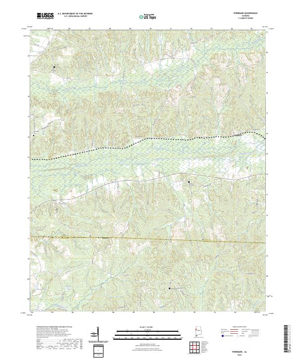
2024 Map of Fernbank
USGS Topo · Published 2024About this map
Fernbank anchors this landscape in western Alabama, positioned just north of the Lamar Co Pickens Co boundary. The area is defined by the winding paths of Luxapallila Creek and Mud Creek, which flow through a mix of wooded terrain and lowlands. Local genealogy is well-documented through several historic burial sites, including Old Harmony Cem, Friendship Cem, and Spring Hill Cem. Near the southern edge, the Andrews Chapel Cem sits along Liberty Rd. The map also illustrates private and agricultural land management through the recurring Farm Service Agency Interest of Alabama designations. To the west, the presence of Speeds Lake and Boggess Lake indicates a watery, low-lying environment near the Caston Rd corridor. This survey provides a contemporary look at the rural road network and water bodies that have long shaped the Lamar County borderlands.
Find a feature on this map
53 named features on this map. Tap any name to fly to it.
Don’t see what you’re looking for? This feature index may not catch every label — zoom into the map to look around manually.
Map Details
Editions of this 2024 Fernbank Map
This is the sole edition of this map. No revisions or reprints were ever made.
Other maps of this area

1953 · West Point
USGS Topo · 1:250,000

1958 · West Point
USGS Topo · 1:250,000

1960 · Caledonia
USGS Topo · 1:62,500

1960 · Columbus
USGS Topo · 1:62,500

1963 · West Point
USGS Topo · 1:250,000

1966 · Ethelsville
USGS Topo · 1:24,000

1967 · Hightogy
USGS Topo · 1:24,000

1967 · Millport
USGS Topo · 1:24,000

1967 · Millport NW
USGS Topo · 1:24,000
1967 · Reform
USGS Topo · 1:24,000