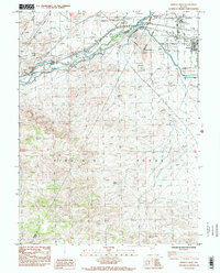
1985 Map of Fernley West
USGS Topo · Published 1985About this map
The Truckee River carves through the arid landscape of western Nevada, serving as the central artery for irrigation and infrastructure in the mid-1980s. This survey captures a vital junction of water management where the Truckee Diversion Dam and Derby Dam facilitate the redirection of river water into a major Canal. The settlement of Fernley sits at the eastern edge of the map, positioned near the intersection of the Southern Pacific railroad and early highway corridors.
Find a feature on this map
27 named features on this map. Tap any name to fly to it.
Don’t see what you’re looking for? This feature index may not catch every label — zoom into the map to look around manually.
Map Details
Editions of this 1985 Fernley West Map
2 editions found
Other maps of this area

1890 · Wadsworth
USGS Topo · 1:125,000

1891 · Wabuska
USGS Topo · 1:125,000

1892 · Wadsworth
USGS Topo · 1:125,000

1894 · Wadsworth
USGS Topo · 1:125,000

1894 · Wabuska
USGS Topo · 1:125,000

1957 · Churchill Butte
USGS Topo · 1:62,500

1957 · Two Tips
USGS Topo · 1:62,500

1957 · Wadsworth
USGS Topo · 1:62,500

1957 · Silver Springs
USGS Topo · 1:62,500

1957 · Reno
USGS Topo · 1:250,000