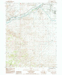
1985 Map of Fernley West
USGS Topo · Published 1985About this map
The Truckee River corridor serves as the primary lifeline through this arid landscape at the junction of three Nevada counties. Moving east, the river and the Southern Pacific tracks provide the infrastructure that supports the growing community of Fernley, situated at the edge of the Fortymile Desert. The map documents a complex water management system including a Diversion Dam, a Gaging Station, and various canals that divert the river's flow for local irrigation and use.
Find a feature on this map
23 named features on this map. Tap any name to fly to it.
Don’t see what you’re looking for? This feature index may not catch every label — zoom into the map to look around manually.
Map Details
Editions of this 1985 Fernley West Map
2 editions found
Other maps of this area

1890 · Wadsworth
USGS Topo · 1:125,000

1891 · Wabuska
USGS Topo · 1:125,000

1892 · Wadsworth
USGS Topo · 1:125,000

1894 · Wadsworth
USGS Topo · 1:125,000

1894 · Wabuska
USGS Topo · 1:125,000

1957 · Churchill Butte
USGS Topo · 1:62,500

1957 · Two Tips
USGS Topo · 1:62,500

1957 · Wadsworth
USGS Topo · 1:62,500

1957 · Silver Springs
USGS Topo · 1:62,500

1957 · Reno
USGS Topo · 1:250,000